Save Days. Cut Costs.
Get It Done.
Faster Data.
Smarter Decisions.
Eliminate Guesswork.
Execute With Precision.
Accuracy That Eliminates Rework
Skyline delivers 99.9% accurate data for every mission. Eliminate guesswork, reduce costly mistakes, and move forward with confidence on every project.
Data When You Need It
We capture and process real-time data fast so you can make decisions on the ground without delay. Faster insights = faster execution.
Cut Costs, Not Corners
Drones replace slow, expensive methods cutting labor, reducing delays, and speeding up your timeline. Skyline gives you more value with less overhead.
Keep Your Crews Out of Harm’s Way
Our drones capture high-precision data from a safe distance no need to put boots on the ground in risky or hard-to-reach areas.
Tailored Mapping for Your Mission
Every site is different. We design drone missions around your goals custom flight paths, data outputs, and reporting that fit your exact needs.
Instantly Compatible with Your Systems
Skyline’s deliverables plug directly into your GIS, CAD, or project management tools providing data you can use right away with zero friction.
Skyline Drone delivers precision-driven aerial data for industries where time, accuracy, and execution matter. From construction to infrastructure, our drone technology transforms how you gather, analyze, and act on information. We replace outdated methods with real-time insights helping you reduce costs, eliminate rework, and accelerate decision-making.
When you work with Skyline, you don’t just get a service you gain a strategic edge.
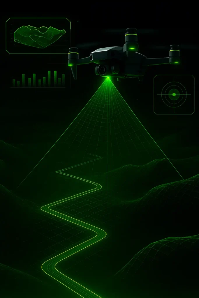
Every map and model we create is 99.9% accurate.
Using advanced drone sensors and ground control workflows, Skyline captures every detail with precision reducing errors, eliminating guesswork, and preventing costly rework.
Get real-time data. Make faster decisions.
Skyline’s drone mapping drastically reduces timelines so you can spot problems earlier, keep your projects moving, and stay on schedule without delay.
Our Process
Let’s Talk Project Goals
Tell us what you’re working on we’ll recommend the smartest drone mapping solution to hit your targets faster, with precision and zero guesswork.
01
We Fly. You Focus.
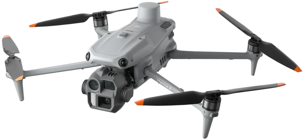
Our drones capture ultra-accurate aerial data whether it's land, buildings, infrastructure, or terrain. We handle every detail so you don’t have to.
02
Actionable Data. Delivered Fast.
We turn aerial data into highly accurate maps and 3D models, optimized for your workflows and ready to plug into your decision-making tools.
03
Turn Data into Results
Use real-time, high-precision insights to make better calls, adjust plans on the fly, and move your project forward with confidence and speed.
04
OUR BENEFITS
Get enterprise-grade results in record time. No bottlenecks. No delays. Just rapid, high-precision aerial data exactly when you need it.
Up to 99.9% precision. Skyline’s tech and expert workflows ensure every detail is captured with accuracy that minimizes rework and maximizes trust.
Outperform traditional methods at a fraction of the cost. Save on labor, reduce downtime, and stretch your budget further without sacrificing quality.
Keep your team out of hazardous zones. Our drones collect the data remotely while ensuring compliance with industry safety standards.
Access live data as it's captured. Make confident decisions faster, keep your timelines intact, and move your project forward without hesitation.

tESTIMONIALS
Real feedback from real projects. We’re proud to help our clients get accurate data, save time, and build with confidence.
Posted on GoogleTrustindex verifies that the original source of the review is Google. Got the pleasure of working with these guys top notch in every way you won’t be disappointed. Thanks guys!!!Posted on GoogleTrustindex verifies that the original source of the review is Google. Skyline Drone Mapping handled both our aerial site inspection and interior scan project in Corpus Christi, and the precision blew us away. Their orthomosaic mapping gave us a crystal-clear, centimeter-accurate view of the entire site—perfect for tracking progress, planning upgrades, and verifying contractor work. Inside the facility, the 3D interior scans created a digital model that made space planning and safety reviews incredibly easy. The team was professional, detail-oriented, and quick to deliver final maps and visuals. If your business needs drone site inspections, orthomosaic maps, or interior scans in Corpus Christi or anywhere in South Texas, Skyline Drone Mapping is the top choice. Their drone mapping accuracy, photogrammetry workflows, and inspection visuals save time, money, and guesswork.Posted on GoogleTrustindex verifies that the original source of the review is Google. Incredible experience with Skyline Drone Mapping! We recently had Skyline Drone Mapping come out to our property to create updated site maps for some future neighborhood development plans, and I couldn’t be happier with the results. Their pilot, Michael, was extremely professional and knowledgeable — he showed up on time, explained the entire process, and captured everything we needed with precision. The quality of the drone maps was outstanding and gave us exactly the data we needed to move forward confidently with our planning. On top of that, Skyline’s pricing was very competitive, especially for the level of detail and service they provide. Their customer service was second to none — quick communication, flexible scheduling, and a genuine commitment to making sure we were satisfied. I’d highly recommend Skyline Drone Mapping to anyone in need of aerial mapping or drone work. They truly went above and beyond!Posted on GoogleTrustindex verifies that the original source of the review is Google. “Skyline Drone Mapping produced an incredible drone tour and FPV fly-through video for our property here in Corpus Christi, and it completely blew us away. The aerial cinematography and first-person drone shots made the entire property come alive — from smooth exterior fly-bys to seamless interior transitions. It looked like something straight out of a professional commercial! Their team handled everything with precision and creativity, using FPV drones for immersive motion and 4K stabilized aerial cameras for stunning wide shots. The final drone video tour perfectly showcased our property layout, design features, and atmosphere. It’s perfect for real estate listings, marketing campaigns, and virtual walkthroughs. If you’re in Corpus Christi, Padre Island, or anywhere along the South Texas coast, I highly recommend Skyline Drone Mapping for drone fly-throughs, FPV drone tours, real estate drone videos, and cinematic property showcases. Their work combines precision flight paths, smooth transitions, and pro-level editing — everything you need for a truly next-level aerial experience.”Posted on GoogleTrustindex verifies that the original source of the review is Google. We brought in Skyline Drone Mapping to create an FPV drone fly-through video of our barbershop here in Corpus Christi, and the results were unreal! The drone tour captured every angle of the shop — from the street view right through the front door, weaving between chairs, lights, and customers with perfect precision. It felt like something straight out of a commercial! Michael and Morgan handled everything professionally — creative planning, safe flight paths, and expert editing that matched our shop’s vibe perfectly. The finished drone fly-through video has already boosted our visibility online and looks incredible on our social media and Google page. If you’re a barbershop, salon, restaurant, or any local business in Corpus Christi or South Texas wanting cinematic FPV drone tours or aerial fly-throughs to showcase your space, Skyline Drone Mapping is the team to call. Their drone videography, FPV footage, and high-quality editing make your brand look elite.Posted on GoogleTrustindex verifies that the original source of the review is Google. I worked with Skyline Drone Mapping in Corpus Christi to capture my surf training sessions as I prepare for upcoming competitions. The footage is helping me analyze my wave positioning and turns from a new angle. Having the full aerial view is making a huge difference in breaking down my form. The team is very professional, punctual, and brought excellent equipment — the overall video quality is just what I needed. The Skyline team knows how to capture surfers and motion in a way that helps you see progress. If you’re in Corpus Christi or anywhere along the Texas coast and want drone surf videos or professional ocean footage, I highly recommend Skyline Drone Mapping. They’re not just mappers — they create high-end surf and sports videos too. I’ll definitely be using them again.Posted on GoogleTrustindex verifies that the original source of the review is Google. “Skyline Drone Mapping created an incredible FPV drone fly-through video of our warehouse facility in Corpus Christi, and it turned out better than we could have imagined. The drone tour showcased the size of our space, equipment layout, and operations with smooth, cinematic motion that makes the video feel like a virtual walkthrough. The team handled everything professionally — safe indoor flight planning, perfect lighting, and editing that highlighted our workflow and efficiency. The final warehouse drone video looks amazing on our website and social media and has already impressed clients. If you manage a warehouse, manufacturing plant, logistics center, or industrial facility in South Texas, you need to call Skyline Drone Mapping for FPV drone fly-throughs, commercial drone tours, and aerial videography. Their industrial drone footage delivers precision, scale, and cinematic quality that truly sets your operation apart”Posted on GoogleTrustindex verifies that the original source of the review is Google. Skyline Drone Mapping flew our ranch and lake property near Corpus Christi to create aerial maps and a full 3D video of the land. The accuracy and detail were incredible—we could see elevation changes, fences, and water features perfectly. The final video was stunning and super helpful for managing improvements and showcasing the property. These guys know mapping, modeling, and real estate visuals better than anyone around. If you’re in South Texas and need drone mapping, ranch aerial photography, or rural property videos, Skyline Drone Mapping is who you call!Posted on GoogleTrustindex verifies that the original source of the review is Google. Highly recommend for any drone applications. Extremely professional and always on time.
Real feedback from real projects. We’re proud to help our clients get accurate data, save time, and build with confidence.


