Orthomosaic Mapping (2D) in Corpus Christi, TX

Survey-Grade Aerial Basemaps for Planning, Measurement, and Confident Decision-Making

Accurate, Georeferenced Aerial Basemaps Across Texas

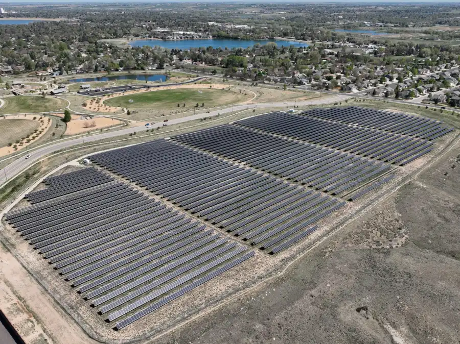
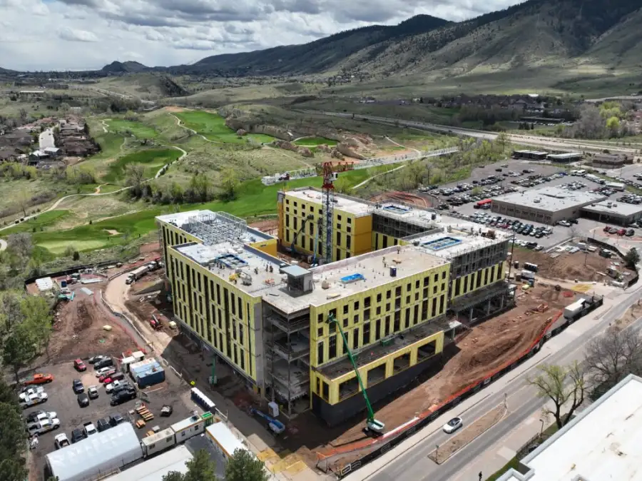
Skyline Drone Mapping (SDM) delivers enterprise-grade orthomosaic maps using RTK/PPK positioning, repeatable flight parameters, and rigorous quality control. Unlike standard aerial photos, orthomosaics are georeferenced and scale-corrected, allowing real-world distances, areas, and features to be measured reliably.

The result is a defensible 2D basemap that integrates directly into GIS and CAD workflows and can be reused across teams, projects, and time. Contact us today to learn more.

What Orthomosaic Mapping Solves

Orthomosaics establish a single source of visual truth, replacing guesswork with measurable, repeatable data. This service is best suited for organizations that need current, trustworthy aerial basemaps to support operational, engineering, or planning decisions.
Common challenges addressed:

What We Deliver

Deliverables Table ← Scroll horizontally →
Deliverable Output Formats Common Uses
High-Resolution Orthomosaic GeoTIFF, KMZ Basemaps, planning, documentation
Web-Based Map Viewer Secure cloud link Stakeholder review & collaboration
Measurement-Ready Data GIS / CAD compatible Area, distance, and feature measurement
Repeatable Capture Sets Time-series datasets Progress tracking & change detection

How Orthomosaics Are Used Across Industries

SDM supports a wide range of public and commercial clients across Texas, including:

Accuracy, Workflow & Standards

SDM orthomosaic workflows are designed for consistency, reliability, and repeatability:
This approach ensures orthomosaics can be confidently reused across multiple stakeholders and project phases.
Accuracy & Intended Use: Deliverables are produced using RTK/PPK workflows, standardized flight parameters, and industry-standard photogrammetry software. Accuracy varies based on site conditions, control placement, and project scope. Orthomosaic maps are intended for planning, visualization, measurement, and analysis unless otherwise specified. They are not a replacement for stamped boundary or legal land surveys unless explicitly scoped and coordinated.

Who This Service Is For

Orthomosaic mapping is trusted by decision-makers and technical teams who need reliable spatial data:

How Projects Are Scoped

Orthomosaic mapping projects are typically scoped based on:
This flexibility allows orthomosaics to be deployed as standalone deliverables or recurring programs.

Frequently Asked Questions

Accuracy depends on flight altitude, overlap, positioning method (RTK/PPK), and ground control. Typical projects achieve centimeter-level relative accuracy suitable for planning and measurement.
Yes. Orthomosaics are delivered in GIS- and CAD-compatible formats such as GeoTIFF and KMZ.
They can be captured as one-time deliverables or on recurring schedules (weekly, monthly, or milestone-based).
Orthomosaics complement surveys but do not replace stamped boundary or legal surveys unless explicitly scoped.
SDM is based in Corpus Christi and serves clients throughout Texas. We work on projects of all sizes, from small urban sites to large rural corridors, and can mobilize statewide depending on project scope.

Learn More About Orthomosaic Mapping

Not sure if orthomosaic mapping is the right fit? SDM will help you select the right workflow based on accuracy requirements, site conditions, and end goals. Contact us today to get started.