Precise Volumetrics and Progress Mapping for Construction, Landfill, and Infrastructure Projects
Drone-based measurements and analytics convert aerial data into quantifiable, decision-ready outputs. Where traditional methods require significant labor, schedule disruption, or manual estimation, SDM’s measurement workflows capture site-wide spatial data quickly and process it into reliable quantities, surface models, and change records.
Skyline Drone Mapping offers measurements & analytics services built on RTK/PPK positioning, rigorous QA/QC protocols, and professional-grade photogrammetry software. Outputs are formatted for direct integration into GIS, CAD, construction management, and reporting platforms.

SDM’s measurement and analytics services serve organizations that require objective, repeatable spatial data to support operations, planning, compliance, and project oversight.
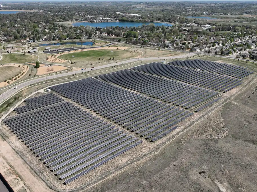
Industries served include construction and civil contracting, landfills and earthworks, energy and utilities, materials suppliers and aggregate yards, public agencies and capital program management, and engineering and development firms.
Roles that commonly engage these services include project managers and superintendents, engineers and consultants, operations and site managers, capital program and facilities managers, and environmental and compliance personnel.
| Deliverable | Output Format | Common Use Cases |
|---|---|---|
| Stockpile Volume Reports | PDF, CSV | Inventory tracking, billing verification |
| 3D Surface Models | LAS/LAZ, GeoTIFF | Volume calculations, site analysis |
| Cut/Fill Analysis | GIS / CAD layers | Earthwork planning and verification |
| Time-Series Orthomosaics | GeoTIFF, KMZ | Progress tracking and documentation |
| Progress Reports | PDF, CSV | Stakeholder updates, owner reporting |
| Volumetric Change Analysis | Tables, charts | Earthwork and material depletion tracking |
| Site Condition Imagery | Annotated photos | Issue identification, record-keeping |
| Web-Based Viewer | Secure cloud link | Remote review and team collaboration |

SDM measurement workflows are designed for accuracy, repeatability, and professional defensibility across both service lines.
Standard workflow components include RTK/PPK positioning for precise geospatial control, ground control point integration when required by project scope, consistent flight parameters maintained across all capture intervals, Pix4D-certified processing with documented QA/QC review, and deliverables formatted for GIS, CAD, and project management platforms.
These standards produce datasets that align reliably across time, supporting comparison, change detection, and long-term program use.
Measurement projects are scoped based on the factors relevant to each service.
For Volumetrics & Stockpile Measurement, scoping considers the number and size of stockpiles or measurement areas, one-time versus recurring capture frequency, accuracy requirements relative to operational or reporting use, and deliverable format needs.
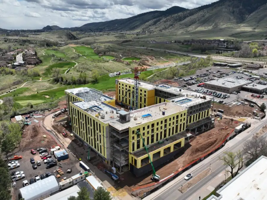
For Construction Progress Mapping, scoping considers project size and site complexity, capture frequency (weekly, biweekly, monthly, or milestone-based), reporting requirements (internal, owner-facing, or public), and whether volumetric measurement is included alongside progress documentation.
Both services can be deployed as standalone engagements or structured as recurring programs aligned to project schedules and reporting cycles.
SDM measurement outputs are produced using RTK/PPK positioning and professional photogrammetry software. Accuracy varies based on site conditions, surface characteristics, ground control configuration, and project scope.
Deliverables across both service lines are intended for planning, operational tracking, documentation, coordination, and reporting. They do not replace certified weight-based measurements, contractual pay applications, or stamped surveys unless explicitly scoped and agreed upon in advance.
Volumetrics focuses on calculating material quantities from stockpiles, earthworks, or excavation areas. Construction progress mapping provides time-series documentation of site-wide conditions, including progress, sequencing, and visual records. Both can be delivered together as part of a combined reporting program.
When scoped with appropriate ground control and RTK/PPK positioning, volumetric measurements achieve accuracy suitable for operational, planning, and reporting purposes. Project-specific accuracy documentation is available on request.
No. Flights are planned to work around active operations. Crews continue working while aerial capture takes place.
Frequency depends on project pace, material turnover, and reporting requirements. Weekly and biweekly cadences are common for active construction sites. Monthly intervals are typical for longer-duration programs.
Time-stamped, consistently captured datasets provide objective documentation of site conditions and quantities. That record has been used to support schedule, scope, and material disputes on active projects.
Yes. Outputs are formatted for direct use in GIS platforms, CAD software, and standard project management tools. Custom formats are available for specific integration requirements.
Both services are available as one-time engagements and as recurring programs structured around project schedules or reporting cycles.
Turnaround depends on site size, deliverable complexity, and project scope. SDM prioritizes timely delivery to keep project teams and reporting cycles on schedule.