Drone Mapping Services in Portland, TX

Get Your Data From Above

A standard survey can take weeks to wrap up. Old aerial photos miss the changes moving across your site every month. Skyline Drone Mapping gives Portland developers, builders, and project managers current data collected in a single visit, so your decisions match the site as it stands today. Whether you are opening a new subdivision off US-181, grading a commercial pad, or tracking a residential build near Corpus Christi Bay, we fly, we collect, and we deliver the data your team needs.
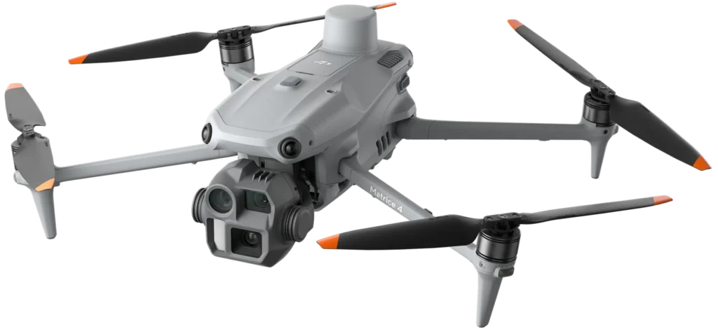
DJI Matrice 4 multi-sensor drone.
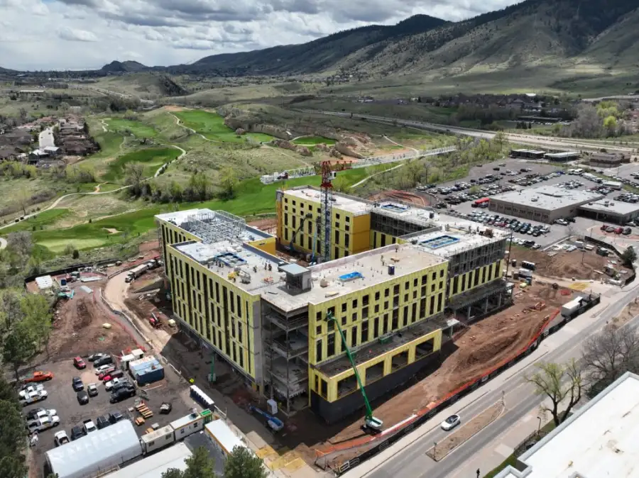
Drone inspecting commercial construction site

Providing Drone Mapping Services in Portland

Skyline Drone Mapping serves clients across San Patricio County and the wider Coastal Bend with FAA-certified pilots and professional drone equipment. We return survey data, inspection reports, 3D models, and aerial media on a quick schedule. Our team understands the sectors that shape Portland, from residential growth and construction to land development and nearby industry, and we plan our flights around the way those projects move.
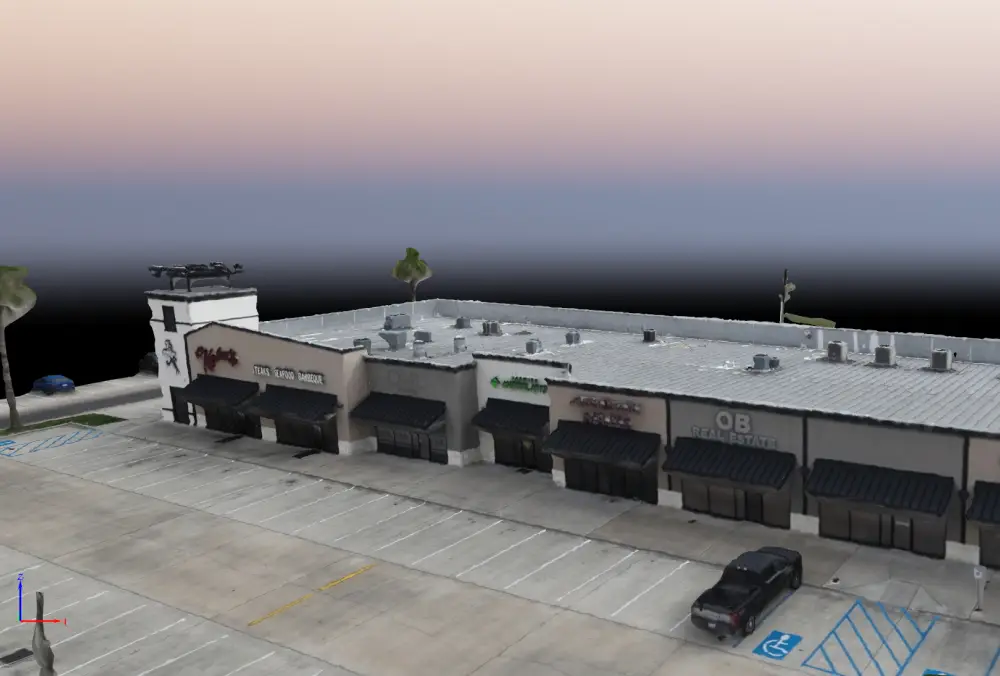
Drone mapping software screenshot

Drone Mapping Services We Offer in Portland, TX

Portland keeps growing with new subdivisions, commercial pads, and land under development, and each one needs its own aerial data. We cover the full range below.

Services include:

Mapping & Surveying

Our mapping and surveying services collect high-resolution aerial data across your entire site in a fraction of the time a ground survey takes. You get orthorectified maps, topographic data, and boundary records that developers, engineers, and city offices in Portland can act on the same week.

Measurements & Analytics

Our measurements and analytics services turn aerial imagery into precise numbers. We measure stockpile volumes, run cut-and-fill for grading, and calculate acreage for tracts and lots. We pull the figures that matter and deliver them in the file types your team already uses. Developers and contractors around Portland rely on accurate data, and that is what we provide.

Inspection & Monitoring

Our inspection and monitoring services put a camera where climbing is slow or unsafe. We inspect rooftops, water towers, storage structures, and equipment across the Portland area. The visual reports we deliver help you catch problems early, before they turn into delays.

3D & Digital Models

Our 3D and digital modeling services turn aerial imagery into point clouds, mesh models, and digital twins of your site or structure. Engineers, architects, and project managers in Portland use these models to plan, review, and report on progress without driving out to the site.

Creative & Marketing

Our creative and marketing services produce aerial video and photography that show your property, project, or business from above. New home listings, development announcements, and commercial content all gain from a view from the air. Portland businesses and builders use our footage to draw buyers and show the scope of a project.

Drone inspecting commercial construction site

Why Portland Businesses Choose Skyline Drone Mapping

We built our service around the work that drives this growing city. Here is what that means in practice:
Drone mapping software screenshot

How Our Process Works

We keep the steps simple so your team can spend its time on decisions instead of coordination.

Here is what happens:

You contact us with your project details

Reach out by phone or through our website. We ask a few questions about your site, timeline, and deliverable needs to scope the job correctly.

We review your site and flight requirements

Our team checks airspace authorizations, site access, and any local restrictions around your Portland location. We handle the FAA coordination so you do not have to.

We fly your site

On flight day, our certified pilots collect data with precision. We follow a structured flight plan built around your project goals - coverage area, resolution, and capture angle are all set before we leave the ground.

We process and analyze your data

Raw imagery goes through our processing pipeline to produce maps, models, measurements, or inspection reports depending on your order. We check every deliverable for accuracy before it leaves our hands.

We deliver your files and walk you through the results

You receive your data through a secure link. For complex deliverables like 3D models or full inspection reports, we schedule a brief review call so you can ask questions and put the data to work right away.

Serving Businesses and Landowners in the Portland Area

We know Portland and the growing communities around it. From new subdivisions off US-181 to commercial sites near Corpus Christi Bay and land parcels across San Patricio County, we understand the scale and pace of development here. Our drone mapping company serves clients throughout Portland, TX and nearby towns including Gregory, Ingleside, Aransas Pass, Rockport, and Corpus Christi.

Frequently Asked Questions

We work across construction, land development, real estate, industrial services, and energy. In Portland, many of our clients are residential and commercial builders, land developers, and property owners, along with facility operators nearby. If your project involves land, structures, or infrastructure, we have likely handled something similar.
Sites under 50 acres usually take one to two hours to fly. Larger properties or complex jobs like multi-structure inspections run longer. We give you a realistic estimate while scoping the project, so your team can plan around our visit.
Most projects turn around in 24 to 72 hours. Basic maps and aerial photos are often ready the same day or the next morning. Detailed work such as 3D models and inspection reports takes a bit longer to process. We confirm the delivery window before every job.
Not much. If your site has gates or access limits, we need entry details ahead of time. For larger or busier sites, walking us through your main concerns before flight day helps us prioritize coverage. We handle all FAA airspace coordination, so that responsibility is ours.
It depends on the service. Mapping jobs deliver GeoTIFF orthomosaics and elevation models. Point clouds come in LAS or LAZ. 3D models come in OBJ or another standard format. Inspection reports arrive as PDFs with annotated images. Aerial video ships in MP4 at broadcast quality. If your team runs specific software, tell us and we will format to match.
Yes, with proper coordination. Job sites, industrial areas, and neighborhoods each carry their own rules, and some airspace near the bay needs clearance. We handle that process and fly within the limits set for your location. We also carry full liability coverage on every commercial flight.
We capture sub-inch resolution for close inspection work and around 1 to 3 centimeters per pixel for mapping projects. The target depends on your project. Higher resolution takes more passes and longer flights, so we match it to what your deliverable needs.
Yes. Progress monitoring is one of the most common requests we get from construction and development teams. We schedule flights on a set cycle, process each round the same way, and return reports you can compare across dates. That makes it easy to track grading, earthwork, and build milestones.
We reschedule at no penalty. High wind, rain, and low visibility lower data quality, so we do not fly in those conditions. Coastal weather can shift fast, so we stay in touch as the date nears and flag any change as early as we can.
Yes. Portland has seen steady growth in new subdivisions and commercial projects. We provide site mapping, grading and earthwork tracking, boundary documentation, and aerial photos for development marketing. Developers and builders use this data to plan lots, track progress, and sell projects.
Mapping covers a wide area to produce survey-grade outputs like maps, elevation data, and volume figures. Inspection moves in close for high-detail images of one structure, such as a roof, tower, or piece of equipment. Both use drones, but the flight plan, sensors, and results differ. We help you pick the right one during the first call.
Yes. Our creative and marketing service is built for that. Home listings, development announcements, and commercial promotions all benefit from aerial photos and video. We deliver footage at broadcast quality and can format it for web, social media, or print.

Get Drone Mapping Services in Portland, TX

Your project moves faster when the data is accurate. Skyline Drone Mapping gives Portland businesses the aerial view they need to build, manage, and grow. Whether you need a site surveyed, a structure inspected, or a 3D model of your project, our team is ready to fly. Contact us today and we will get your project scoped and scheduled.